FY banner logo

  • ABOUT US
    • About The Friends of Fort York
    • Board of Directors
    • Our Vision
    • Our Mandate
    • Our Accomplishments
  • JOIN US
    • Donate To The Friends
    • Recognition and Sponsors
    • Subscribe to The Fife and Drum
  • CONTACT
  • SEARCH
  • Home
  • History of Fort York
  • News & Events
    • News
    • Events
      • Archived Events
  • Plan Your Visit
    • Plan Your Visit
    • Hours, Rates, & Admission
    • Directions
    • Accessibility
    • FAQ
    • Rent our Facilities
    • Visiting Toronto
  • Featured Attractions
    • Structures
    • Exhibits
    • Fort York Guard
      • The Fort York Guard
      • Volunteer with the Guard
      • Job Opportunities
    • Historic Foodways Programme
    • Canteen Museum Store
    • Fort York Community Garden
    • Volunteer at Fort York
  • Resources
    • Newsletter & Archive
    • Historical Essays
    • Fort York Maps
    • Documentary Videos
    • Fort York Bibliography
    • Management Docs
    • Links
    • Image Credits
  • Gallery
  • Foundation
You are here: Resources Fort York Maps

Fort York Maps

Print | Email

Plan of Fort at York, Upper Canada, shewing its state in March 1816 Drafted by: Royl. Engineers Drwg. Room, Quebec, 16th Feby. 1816, J. B. Duberger, Junr. Quebec, 24th June 1816, G. Nicolls, Lt. Col. Rl. Engineers. Image courtesy Library and Archives Canada: NMC 23139
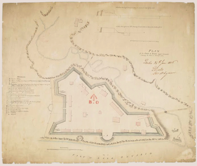
In partnership with Nathan Ng who previously posted two fine websites of maps of Toronto, http://goadstoronto.blogspot.ca/ and http://oldtorontomaps.blogspot.ca/, The Friends of Fort York have assembled a collection of captioned historical maps, plans and a few pictures.

This collection complements our extensive Gallery of photographs, prints, and sketches found on this website.

Visit http://fortyorkmaps.blogspot.ca to view the entire map collection.

top1 top2 top3 top4 top5
bottom1 bottom2 bottom3 bottom4 bottom5 bottom6